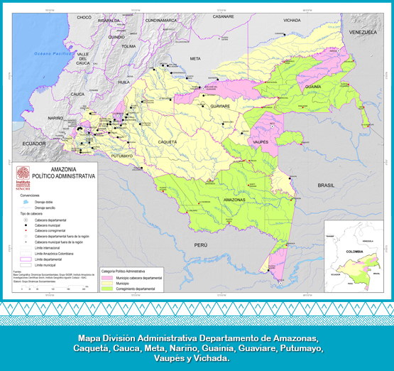
It comprises the entire territories of six departments: Amazonas, Caqueta, Guainia, Guaviare, Putumayo and Vaupes, and a fraction of the following four: Vichada (south of Cumaribo municipality); Meta (complete territory of La Macarena and a fraction of the municipalities of Mapiripan, Mesetas, Uribe, Puerto Concordia, Puerto Gaitan, Puerto Rico, San Juan de Arama and Vistahermosa); Cauca (fraction of the municipality of San Sebastian and the complete territory of Piedmont and Santa Rosa); And Nariño (fraction of the municipalities of Cordoba, Funes, Ipiales, Pasto, Potosi and Puerres). The total area of the region is 483,163 km2.
The departments with the largest participation in the area of the Colombian Amazon are, in order: Amazonas (22.51%), Caqueta (18.64%), Guainia (14.65%), Guaviare (11.01%). With the lowest participation rates we have: Nariño (0.60%), Cauca (1.02%), Putumayo (5.34%), Meta (6.09%) and Vichada (8.74%).
The municipalities with the largest participation in the Colombian Amazon are Solano (Caqueta) and Cumaribo (Vichada) and the smaller ones, Sibundoy and Colon (Putumayo).
In the region there are several categories within the political-administrative order: departments (10), departmental capital municipalities (6) municipalities (52) and the controversial figure of departmental corregimientos or non-municipalized areas (20). (Salazar and Riaño, 2016).
